


Just after the rainy season, California is back to its former Japanese style.
The right temperature, fresh air, a sense of spring. In my eyes, this is not only the most comfortable season of the year, but also a good time to get rid of small fat.
With such a good spring, many foodies and Hikers have agitated a heart to go hiking, leaving messages in the background, asking about our latest Hiking mountain climbing strategy.
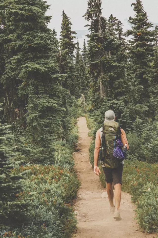
Pictures from the web
Don't worry, this is not coming!
Niu Xiaohua recently realized that the meaning of life is not only about eating, but also about exercise!
So he raised his hand and wrote a mountain climbing guide.
To be honest, the original purpose of this guide was because I honestly suggested everyone to go to the mountain collectively on the weekend.
The mighty leader, this matter was put on the agenda the next day,
The members of the small team complained again and again, especially Aunt 16. After all, her longevity and explosive power only exist at night...

Pictures from the web
But anyway, the squad is going to gather! body! Go! mountain! It's up! See you at the top!
Nanga
Los Angeles area
Xiaohua first came to tell you that the first six Los Angeles hiking guides are easy viewing soy sauce routes, suitable for novice mountaineering.
The last four are relatively professional classic Southern California climbing routes. Hikers with experience are recommended to try.
In fact, if each mountain is really written, Xiaohua said, "Every mountain can be written on a page."
I also encourage everyone to do more homework before Hiking and find the mountain that belongs to them!
1. Hollywood Sign
Keywords: Los Angeles features, Internet celebrity landmarks

Length: 6 ~ 7 Miles
First introduced is the characteristic climbing route of Los Angeles: Charlie Turner Trailhead.
The convenient place to park is the famous Griffith Obervatory. It is recommended that friends can start from Griffith Observatory and follow the guidelines to find Charlie Turner Trailhead. Walk along and see. After 3 Miles, you can see the famous Hollywood Sign up close. Do n’t turn around after seeing the Hollywood Sign! Walk a little longer and go behind the Sign, you can see the beauty of the entire LA.
Note: Because this trail is very famous, parking spaces are quite difficult to find, so go early if you want to go.Details link
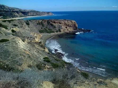
2. Palos Verdes
Keywords: seascape, rapeseed field, glass church
Trailhead: Crenshaw Blvd & Burrell ln, Rancho Palos Verdes, CA 90275
Length: 7 Miles
A very relaxing trail. When the weather is good, you can go hiking, and you can see very beautiful sea views and large rapeseed fields. Perfect for girls to take pictures.
During the climbing, you also have the opportunity to visit the local mansion area to watch the peacocks and horse farms, and the ending point is the beautiful glass church Wayfarers Chapel standing by the sea. Details link (Glass church relatedlink)
3. Santa Anita Canyon Loop
Keywords: tree shade waterfall
Trailhead: Chantry Flats Road, Angeles National Forest, Arcadia, CA, 91006
Length: 8.7 miles
There are many trails on this hill for you to choose from. Whether you choose to take a 2 step to watch the small waterfall, or walk a 10-mile loop, it is a very good experience.
In summer, it is inevitable that the temperature is high and the weather is hot, but most of the Trail here is shaded, and you can also see exquisitely decorated cabins along the road.
Parking costs $ 5 or buys an annual ticket. It is often full on weekends, and it is recommended that cars be parked on the roadside.Details link
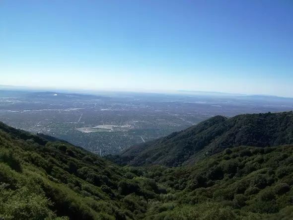
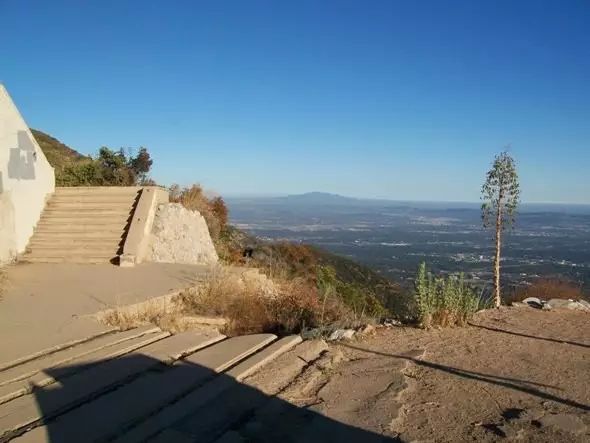
4. Echo Mountain & Inspiration Point
Keywords: small gazebo with big speakers
Trailhead: E loma Alta Dr & Lake ave, Altadena
Length: 5 ~ 15 Miles
Very classic Hiking route. A one-way 2.5-mile walk to Echo Mountain, which not only overlooks the LA area, but also has a big horn that can shout at the mountain. It feels so good to let go of my daily pressure or call Du Minjun ~ Hee hee.
By the way, take another 5 steps to reach Inspiration Point, where there is a small gazebo, a good place to rest. Details link
5. Parker Mesa
Keywords: seascape route
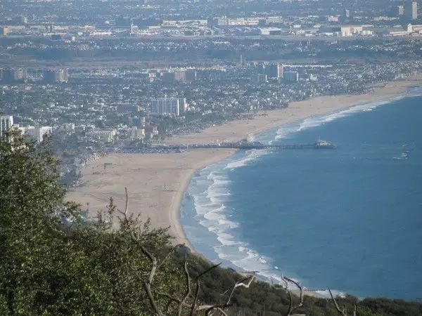
Trailhead: 566 Los Liones Dr, Pacific Palisades, CA 90272
Length: 6.3 Miles
Trail has a low coefficient of difficulty, and you can see the sea. This is a benefit for junior California Hikers. Details link
6. Mountain Sandstone
Keywords: Santa Monica Highest Peak
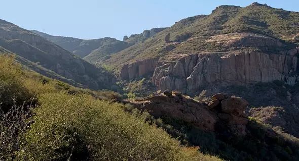
Trailhead: 12896 Yerba Buena Road, Malibu, CA 90265
Length: 6.25 Miles
The highest peak of the Santa Monica Mountains!
It is highly recommended to climb at this time, because the spring scenery and the lush greenery are really beautiful.
The seaside trail is not very difficult, and noon and three or five friends are invited to set out together, and you can climb in half a day. Details link
----------------The dividing line of soy sauce and non-soy sauce-----------------
The following routes are difficult to provide detailed information because the difficulty factor is not low and there are many combinations. I hope that everyone can do more relevant information before going.
7. Mt. Wilson
Keywords: Serious Hiker entry route
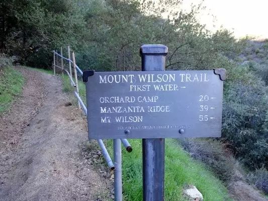
There are many ways to go, and a good entry route for Serious Hiker. Details link
Note: The following routes are most likely to be snow and ice routes in winter. Please do your homework, including equipment, routes, time, etc.
8. Mt. San Antonio (Aka, Mt. Baldy)
Key words:The highest peak in the San Gabriel Mountains, the highest peak in LA County
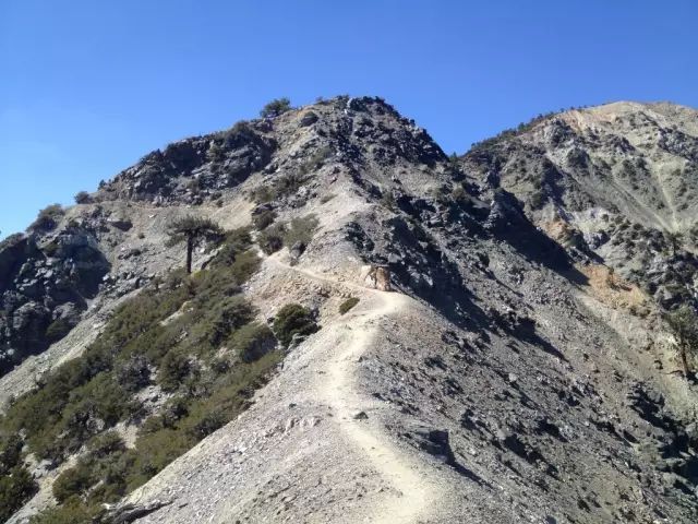
This is the highest peak of the San Gabriel Mountains and LA County. It should be a great sense to complete it ~
It is also a good entry route for Erious Hiker. When you are lucky, you can see the spectacular sea of clouds at the peak of the mountains.. Details link
9. Mt. San Gorgonio
Keywords: Nanjia highest peak
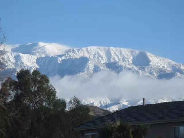
Located in the San Bernardino National Forest (also known as the Big Bear Lake) at an altitude of 11500Ft, it is the highest peak in South Canada. There are multiple routes to choose from.
Tips: Remember to bring enough water, there are signs showing that there is water, but it is all stream water, if you want to replenish the water on site, please bring a filter. In addition, there is a large temperature difference between the top and the bottom of the mountain, so please be prepared.
Especially in winter without equipment and experience can not go casually. A Hiker died on the mountain in April.NewsDetails link
10. Icehouse Canyon Trailhead
Key words:3T Mountain Peak

From this Trailhead, you can go to many famous peaks, such as Cucamonga, such as 3T (short for Timber, Telegraph, Thunder, three climbers, climbers often put them together). Details link
San Diego
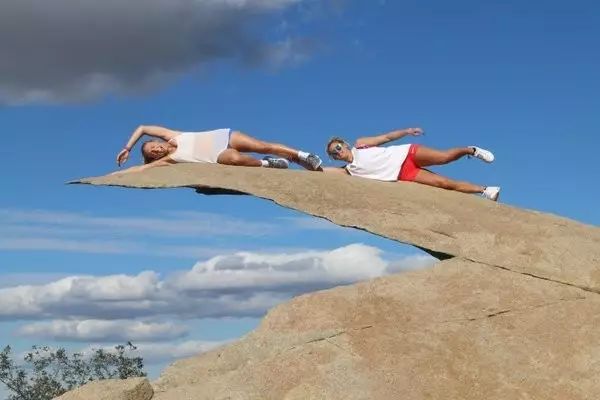
If you're in San Diego, choose to stroll through the scenic Torrey Pine or climb Mt Woodson to see the famous potato chip rock
(Note: It has been smashed by tourists, and you can't cheat on Weibo and WeChat ...).
However, there are actually more than 100 peaks around San Diego, and there are many climbing routes hidden in the rolling mountains.
If you are tired of crowding up with crowds or lining up to take photos by potato chips, then try these lesser-known mountaineering routes and local people know about new scenery!
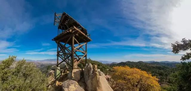
1. The Goat Canyon Railroad Trestle
Key words:World's largest viaduct
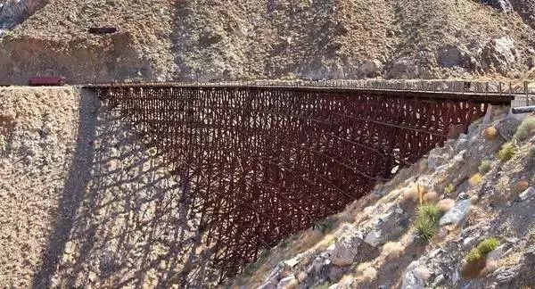
Length: 4 ~ 6 Miles
Starting point: Google maps make people take a lot of detours, so the easiest way is to get off the 8th highway at Ocotillo, and then drive north 9.2 steps all the way, that is the starting point of Mortero Wash.
Anza-Borrego State Park has the world's largest wooden rail viaduct. The difficulty factor for climbing paths without signs or repairs is indeed relatively large, and even the expert Hiking experts will spend a whole day to complete it.
For such a challenging task, you must remember to bring navigation, whether it is GPS, compass, or map. Do not feel that you are the next explorer who can get out of the desert.
It is not surprising to encounter various creatures and climb huge pebbles as you pass the rugged mountain road. I pray that you do not meet the scorching sun or "desert savage"! Bring a lot of water, use scientific knowledge wisely, and carefully consider possible problems.
Once you see the longest wooden bridge in the world, you will find that all the effort is worth it.
2. Sea Caves at Cabrillo National Monument
Keywords: sea cave
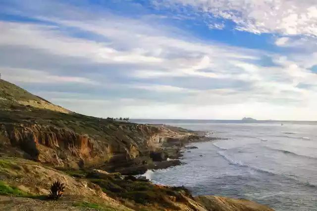
Length: about 1 Mile
Where: 1800 Cabrillo Memorial Dr, San Diego, CA 92106
Hikers may have seen the tidal pools in the Cabrillo National Memorial (a place where the coastal terrain is low and filled with rocks and seawater. When these areas rise, seawater will flood into them, or they will be flooded without tidewater; At low tide, the tide water remaining between the rocks forms one closed pond after another), the mysterious beauty, but at the end of the national park is the beginning of the adventure.
Hidden in the tide pools are sea caves. These caves can only be accessed at low tide, otherwise there is the danger of being drowned by fierce waves. Therefore, grasping the time is the key.
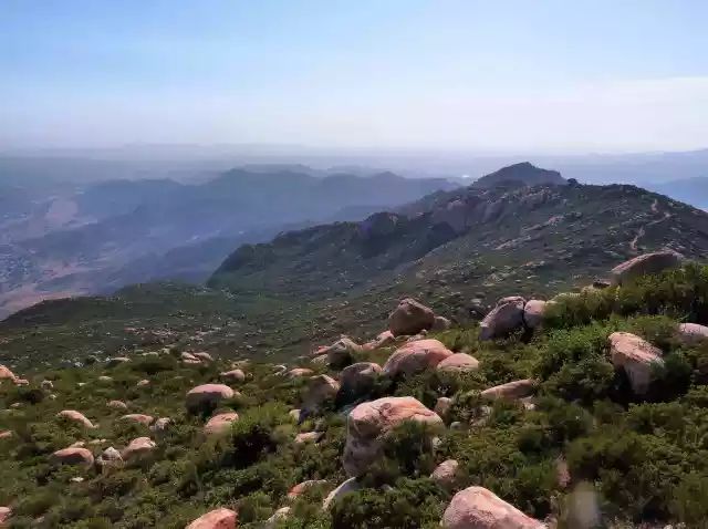
3. Hot Spring Mountain
Keywords: San Diego High Point
Length: about 6 Miles
Starting Point: Borrego Palm Canyon Rd, Warner Springs, CA 92086
The summit of Los Coyotes Nature Reserve, Mount Hot Springs, is the highest point in Santiago.
Unfortunately, some time ago, it was forced to close due to deliberate sabotage by some tourists.
But now the door has been reopened, but tickets need to be paid.
This hiking trail starts at the Los Coyotes camping site, following the hunter's old path, through the dense pine forest, and sitting on the summit of 6553 feet, you will find an ancient observation deck with a 360-degree all-round stunning view.
4. Balboa Park Trails
Key words:19 Hiking routes
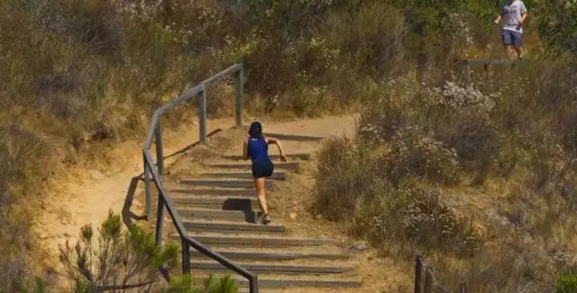
Distance: Various
After climbing so many hills, Balboa Park is the most artistic.
If you want to breathe the most natural air and exercise, then Balboa Park can perfectly meet your needs-19 Hiking routes, with a total length of 65 miles, and different difficulties. Come and personally customize your climbing route ~
5.The Slot
Keywords: Slit Valley
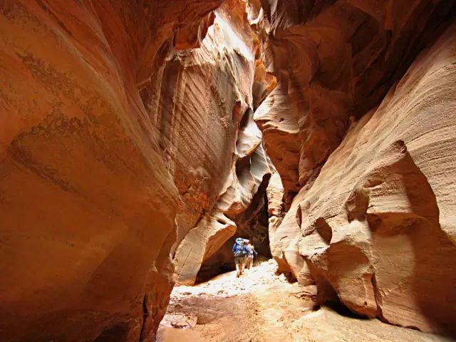
Length: about 1 Mile
Starting Point: Borrego Mountain Wash, Anza-Borrego Desert State Park | 200 Palm Canyon Dr, Borrego Springs, CA 92004
In order to see the gorge (such as the famous Antelope Canyon) to Arizona or Utah is too hard, our lovely San Diego has comparable gorge.
There is no mark so it will be difficult to find, but as long as you reach the bottom of the canyon that is washed away by the flowing water all year round, you can meander and explore slowly.
6. El Cajon Mountain
Key words:The most challenging hiking trails
Length: 11 Miles
Starting point: At the end of Wildcat Canyon Road, there is a sign "El Captain Preserve".
El Cajon Mountain has beautiful views suitable for exercise and is one of San Diego's most famous and challenging hiking trails.
The climbing route is the route left by the workers during the previous mining. It can lead you up and down the mountain and finally climb the 3675-foot peak.
It should be noted that due to the high temperature, this hiking trail was closed throughout August. If you want to climb El Cajon Mountain at other times, you should also bring enough water to do your homework.
7. New Hiking Trail in Black Mountain
Key words:2352 acres of vast land, bike routes
Length: 1.5 Miles
Starting point: 2800 Torrey Pines Scenic Dr, La Jolla, CA 92037
Space Park has 2352 acres of vast land waiting to be explored, and there are seven or eight hiking and cycling routes in Rancho Peñasquitos.
The total length of the new development route connecting Glider Port Trailhead to Miner's Ridge Trailhead is only 1.5 Miles, but the beautiful scenery is waiting for you to discover.
Writing/Compiling | Leo/Shao Yi
Edit | Xiaomi/Lenka
[Compiled fromThrillist.CHIHUOOriginal compilation, pictures from the Internet, for copyright notice or reprint of the full text, please contact info@thechihuo.com]