


Living in San Diego, you can choose to stroll in the scenic Torrey Pine, or climb Mt Woodson to see the famous potato chip rock (note: it has been crawled by many tourists, and you can’t cheat on Weibo and WeChat. ...).But around San DiegoThere are more than 100 peaks, and there are many climbing routes that are worth watching. If you are tired of crowding up with crowds or lining up to take photos by potato chips, then try these little-known climbing routes and see new scenery!
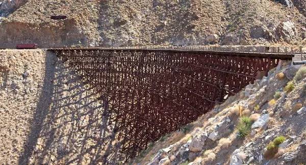
1. The Goat Canyon Railroad Trestle
Length: 4-6 miles
Starting point: Google maps make people take a lot of detours, so the easiest way is to get off the 8th highway at Ocotillo, and then drive north 9.2 steps all the way, that is the starting point of Mortero Wash.
Anza-Borrego State Park has the world's largest wooden rail viaduct.NeitherThe sign is not repaired eitherThe climbing path is more complicated, and even the expert hiking expert takes a whole day to complete.For such a challenging task,Be sure to bring navigation, whether it's GPS or compass plus map, don't feel like you're nextAble to get out of the desertExplorer. throughRugged mountain road,It is not surprising to encounter all kinds of creatures, climb over huge pebbles, and pray not to encounter the scorching sun or "desert savages".Bring a lot of water, use scientific knowledge wisely, and carefully consider possible problems.Once you see the longest wooden bridge in the world, you will find that all the effort is worth it.Details link
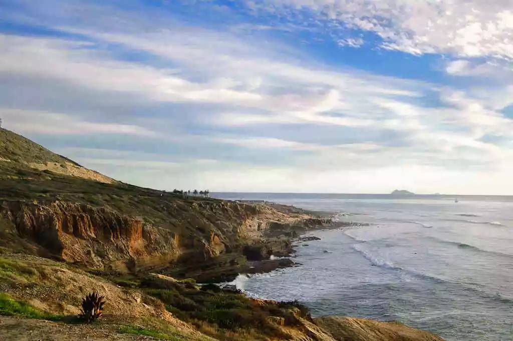
2. Sea Caves at Cabrillo National Monument
Length: about 1 mile
Location: 1800 Cabrillo Memorial Dr San Diego, CA 92106
Hikers may have seen the tidal pools in the Cabrillo National Memorial (a place where the coastal terrain is low and filled with rocks and seawater. When these areas rise, seawater will flood into them, or they will be flooded without tidewater; At low tide, the tide water remaining between the rocks forms one closed pond after another), the mysterious beauty, but at the end of the national park is the beginning of the adventure. Hidden in the tide pools are sea caves, which can only be accessed at low tide, otherwiseStunned by fierce wavesDanger of drowning. Therefore, grasping the time is the key.Details link
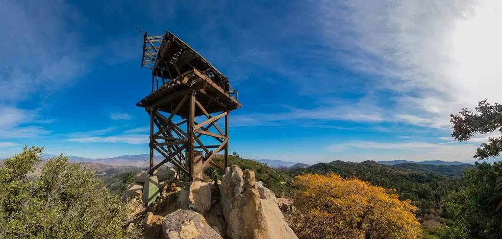
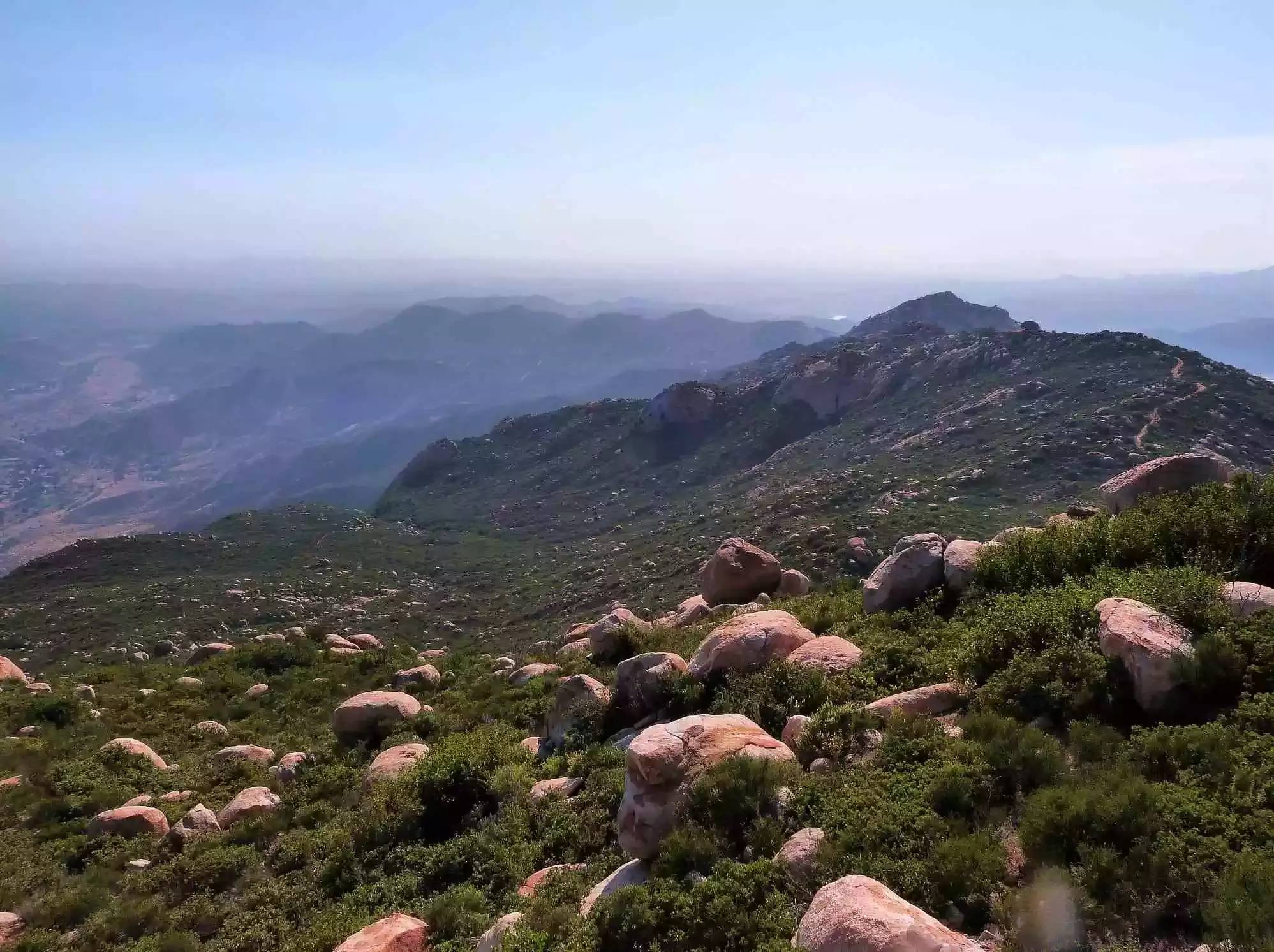
3. Hot Spring Mountain
Length: about 6 miles
Starting point: Borrego Palm Canyon Rd, Warner Springs, CA 92086
The top of Los Coyotes Nature Reserve-Hot Spring Mountain-is San DiegoThe highest point. Unfortunately, some time ago, it was forced to close due to deliberate sabotage by some tourists. The door has been opened again, but you need to pay for the tickets. This hiking trail begins at the Los Coyotes camping site, following the hunter's path, through the dense pine forest, and sitting on the 6553-foot peak, you will find an ancient observation deck and 360-degree all-round dead-end stunning views .Details link
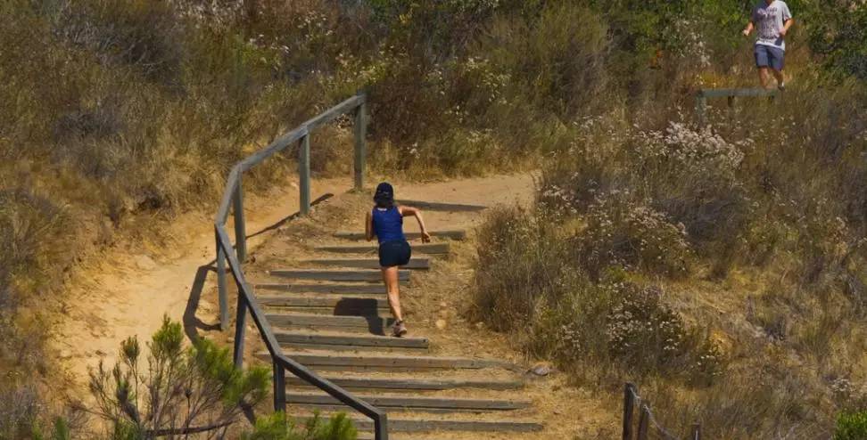
4. Balboa Park Trails
Distance: Various
Balboa Park is not only full of literary atmosphere, but also various hiking trails.If you want to breathe the most natural air and exercise in the deep mountains and old forests, then Balboa Park can perfectly meet your needs-19 hiking routes with a total length of 65 steps and different difficulties. Come and customize your climbing route privately~Details link
5. The Slot
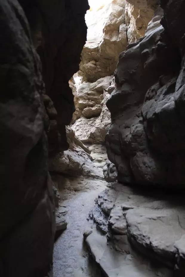
Length: about 1 mile
Starting point: Borrego Mountain Wash, Anza-Borrego Desert State Park, Borrego Springs, CA 92004
In order to see the gorge (such as the famous Antelope Canyon) to Arizona or Utah is too hard, our lovely San Diego has comparable gorge. There is no mark so it will be difficult to find, but as long as you reach the bottom of the canyon that is washed away by the flowing water all year round, you can meander and explore slowly.Details link
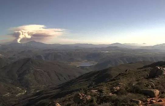
6. El Cajon Mountain
Length: 11 miles
Starting point: At the end of Wildcat Canyon Road, there is the "El Captain Preserve" sign.
El Cajon Mountain has beautiful views suitable for exercise and is one of San Diego's most famous and challenging hiking trails. The climbing route is the route left by the previous mining, leading you uphill and downhill to the peak of 3675 feet. It should be noted that due to the high temperature, this hiking trail was closed throughout August. If you want to climb El Cajon Mountain at other times, you should also bring enough water to do your homework.Details link
7. New Hiking Trail in Black Mountain
Distance: 1.5 miles
Trailhead: 2800 Torrey Pines Scenic Dr, La Jolla, CA 92037
Space Park has 2352 acres of vast land waiting for you to explore. There are seven or eight hiking and biking routes in Rancho Peñasquitos. The total length of the newly developed route connecting Glider Port Trailhead to Miner's Ridge Trailhead is only 1.5 mile, but the beauty in between is waiting for you to discover by yourself.Details link
Compile:Leo
edit:Millet
[Compiled fromThrillist.CHIHUOOriginal compilation, pictures from the Internet, for copyright or reprint, please contact info@chihuo.org]