


Los Angeles has brilliant weather, beautiful scenery, and of course, countless jogging routes. Whether it's a health-conscious resident or a tourist who wants to experience the breathtaking beauty, they will find what they love. From the bustling and noisy DTLA to the magnificent coastline, the team ranks you on the best running route in Los Angeles.
1. Inspiration Point & Clouds Rest – Runyon Canyon
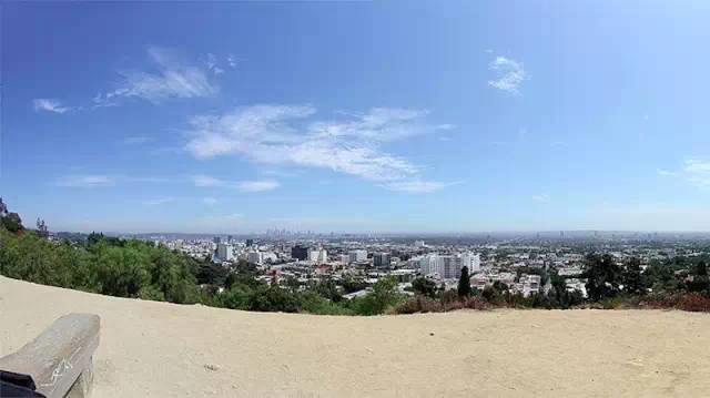
Just two blocks from the world-famous Hollywood Blvd (to the west of Freeway 101 and to the north of Mulholland Drive) there is a huge 130-acre park because celebrities often visit and add 90-acre big dog parks here. Be well known. In the boundless park, you can untie the dog with peace of mind and let it enjoy its freedom. If you want to jog, please start from the entrance of Fuller Avenue, run up the back of the canyon, march towards the east ridge (Cloud Rest), then go down the small slope to Inspiration Point, and finally run across the fire road to the origin! This is a clockwise direction. After warming up and entering the state, you can challenge the counterclockwise direction with a higher degree of difficulty, the slope is also steep, pay attention to your feet when running. Don't worry, both options will give you a panoramic view of Los Angeles. On a clear day, you can still see Katerina Island from a distance!
Address:2000 N Fuller Ave, Los Angeles, CA 90046 (also recommended starting point)
2. Mount Hollywood – Griffith Park
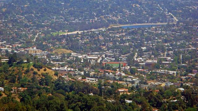
Griffith Park is the tenth largest park in the nation and one of the largest urban parks in North America. Lots of fun are set on 4300 acres of land: LA Zoo, Griffith Observatory, Autry National Center, Greek Theatre. The jogging route runs one day at a time, and it can't be completed in a year. The prominent ones are from Los Feliz Blvd / Riverside Drive to Griffith Park Drive, Crystal Spring Drive to the zoo, and so on. Of course, do you know that there is still a 53-mile climbing network? For a memorable running experience, start from the Griffith Observatory and point directly to the highest point of Mount Hollywood, where you can see the true and complete look of the Los Angeles Basin!
Address:4730 Crystal Springs Dr, Los Angeles, CA 90027 (Recommended starting pointLos Feliz Blvd / Riverside Drive)
3. Rose Bowl Loop
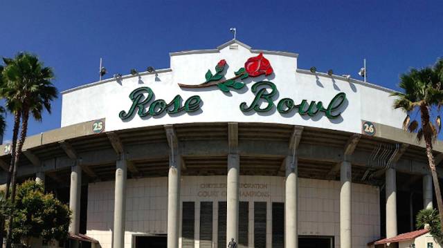
You can choose from running, cycling or horse riding on the 22-foot path of Arroyo Seco in Pasadena! Sometimes the steps are absent, the road is steep and slow, and the road is fun. The rose bowl is the most popular path. The 3-mile loop includes the world-famous Rose Bowl Stadium, Brookside Golf Course, and spectacular Arroyo views. The colorful sidewalks and markings can also help separate pedestrians from motorcyclists.
Address:1001 Rose Bowl Dr, Pasadena, CA 91103 (also recommended starting point)
4. Lake Balboa
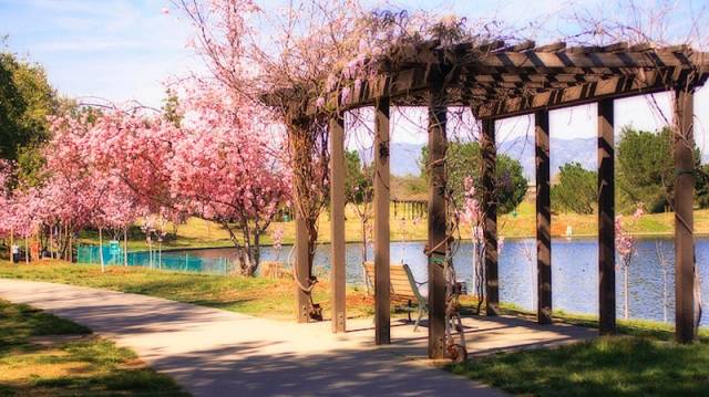
In the basin of the San Fernando Valley is an 80-acre Anthony C. Beilenson Park, and there is still spring water flowing quietly in the center of the 27-acre Lake Balboa. Although the 1.3-mile jog is not far away, you can see young people barbecued, picnic children, old people fishing quietly. The most important thing is that 2000 cherry trees in full bloom bring you a visual feast of breathtaking beauty.
Address:6300 Balboa Boulevard, Van Nuys, CA 91316 (recommended to trot along the lake)
5. Drake Stadium – UCLA
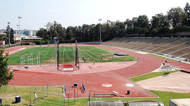
Drake Stadium is the home of UCLA Bruins football, in the northwest corner of the campus. Elvin C "Ducky" Drake is the father of UCLA athletes. He became Bruin in 1923 and dedicated himself to the position of athlete or coach for more than 400 years until his death. He won countless championships, and the track field was named Drake. To commemorate him. Marshall Field is one of the best football stadiums in the United States, and is also named after Oscar-nominated alumni.This standard Olympic track is a good choice for running all year round (the 1500-meter lap of the track reminds me of the XNUMX-meter sports college entrance examination><).Come and run for a few laps, sweat, and recall the physical exams that I ran together in those years, but there are often school team training, so remember towww.recreation.ucla.edu/drakeSchedule your time.
Address:40 Charles E Young Dr N, Los Angeles, CA 90024
6. San Vicente Boulevard – Brentwood

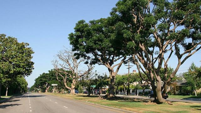
The leafy San Vicente Boulevard is the most popular runway in West Los Angeles. Starting from Federal Avenue, running westward all the way through the Brentwood community, ending at Ocean Avenue. Along the way you can enjoy the magnificent coastal scenery and the mansions on the roadside. The local professional track and field team may quickly pass by. After the red trolleybus was removed in the 1940s, a coral tree planted has become an iconic symbol of the path. Believe that running on such a beautiful path should not feel tired?
Address: Santa Vicente Blvd (House numbers 4600 to 6600 Wilshire Blvd)
7.Palisades Park
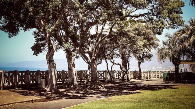
With a comprehensive view of Santa Monica Bay, the 1.5-mile journey from Adelaide Drive to the historic Santa Monica Pier includes more than 30 plants, sculptures, and cannons (yes! The 19th century cannon is a unique landmark). Climb a huge cannon and give yourself Zhang Weifeng's selfie!
Address:Santa Monica, CA 90401 (Recommended starting pointSanta Monica Pier, Santa Monica CA 90401)
8. The Strand – Santa Monica
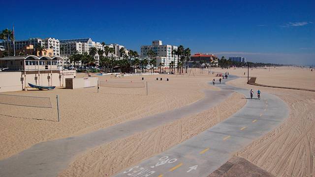
The name that many people have heard of is called the Marvin Braude cycle path, which starts at Will Roger State Park and ends at Torrance County Beach. The journey is 22 miles long. There is of course a sidewalk next to the bike lane, but be careful of the left and right bicycles. The good thing about this path is that there is a beach next to it. You can rush to the sea to take a shower, sunbathe, and then return to the running ranks. Muscel Beach, the well-known outdoor basketball court, Venice Skate Park, etc. are all on the two steps between Santa Monica Pier and Venice Broadwalk.
Starting point Will Roger State Park:1501 Will Rogers State Park Rd, Pacific Palisades, CA 90272
End of Torrance County Beach:Torrance County Beach, CA 90277
9. Ocean Trails – Trump National Golf Club
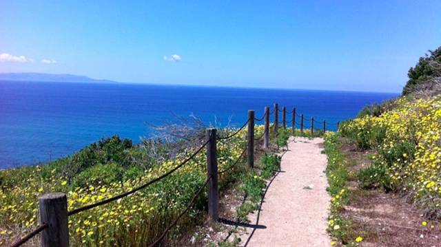
Located on the cliffs of the coast of Palos Verdes Penisula, Trump National Golf Club is a club that blends the golf experience with the beauty of the Pacific Ocean. The Ocean Trail is adjacent to the Trump National Golf Club. The difficulty is divided into multiple levels and the length is about 5 miles. The picturesque scenery along the way ends without knowing it. Running is no longer enduring but enjoyment! From the parking lot at the end of La Rotonda Drive, run along the paved road to the beginning of the path. There are countless trails for you to choose from, run forward with bravery! Catalina Trail, Costal Switchback, and Sagebrush Walk are recommended. Check them out!
Address:1 Trump National Dr, Rancho Palos Verdes, CA 90275 (recommended starting point La Rotonda Dr Rancho Palos Verdes, CA 90275)
Original text fromdiscoverlosangeles.com. Pictures from the Internet.